WEEKEND FORECAST: Brevard County Under Flood Advisory; Excessive Rains, Wind Gusts Expected
October 05, 2025 -- 11:30pm By: Joe Cantoras // TheBlakeMoiaShow.com Certified Chief Meteorologist & Tropical Weather Expert
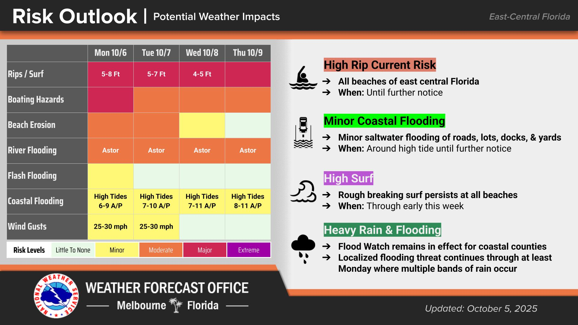
- *A flood advisory has been issued for the viewing area.
- *Forecasts calling for 6-12'' of rainfall through the weekend and into the week.
Inland Volusia, Coastal Volusia, Coastal Indian River, Coastal Saint Lucie, Coastal Martin, Inland Northern Brevard, Inland Indian River, Inland Saint Lucie, Inland Martin, Mainland Northern Brevard, Northern Brevard Barrier Islands, Inland Southern Brevard, Mainland Southern Brevard, Southern Brevard Barrier Islands, Including the cities of Tradition, New Smyrna Beach, Saint Lucie West, Deland, Fellsmere, Jensen Beach, Daytona Beach, Palm Bay west of I 95, Stuart, Vero Beach, Rockledge, Debary, Port Saint John, Melbourne, Ormond Beach, Melbourne Beach, Port Saint Lucie, Viera West, Cocoa Beach, Titusville, Canaveral Groves, Fort Pierce, Mims, Indiantown, Cocoa, Playalinda Beach, Sebastian, Deltona, Merritt Island Wildlife Refuge, Satellite Beach, and Hobe Sound
154 AM EDT Sun Oct 5 2025 ...FLOOD WATCH NOW IN EFFECT THROUGH MONDAY EVENING...
- * WHAT
Flooding caused by excessive rainfall continues to be possible.
- * WHERE
A portion of east central Florida, including the following counties...Volusia, Brevard, Indian River, Saint Lucie and Martin.
- * WHEN
Through Monday evening.
- * IMPACTS
Excessive runoff may result in flooding of rivers, creeks, streams, and other low-lying and flood-prone locations.
- * ADDITIONAL DETAILS
Persistent onshore winds and increasing moisture will cause numerous showers and a few lightning storms to develop today and especially Monday.
- PRECAUTIONARY/PREPAREDNESS ACTIONS
You should monitor later forecasts and be alert for possible Flood Warnings. Those living in areas prone to flooding should be prepared to take action should flooding develop. Motorists are advised to turn around and don't drown should they encounter flood waters. Hazards increased at night due to decreased visibility.
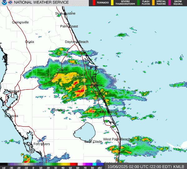
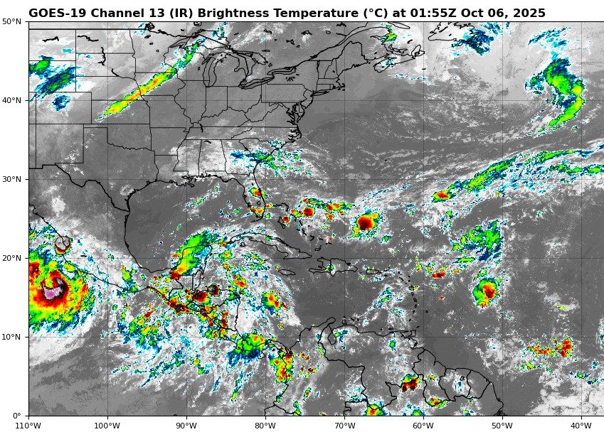
Latest MLB Radar Loop & GOES Satellite Image
- ...FLOOD ADVISORY IN EFFECT UNTIL 1030 PM EDT THIS EVENING...
Flooding caused by excessive rainfall is expected.
- * WHERE
A portion of east central Florida, including the following counties, Brevard and Osceola.
- * WHEN
Until 1030 PM EDT.
- * IMPACTS
Minor flooding in low-lying and poor drainage areas.
- * ADDITIONAL DETAILS
At 826 PM EDT, Doppler radar indicated heavy rain due to thunderstorms. Minor flooding is ongoing or expected to begin shortly in the advisory area.
Between 1.5 and 2 inches of rain have fallen.
Additional rainfall amounts of 1 to 2 inches are expected over the area. This additional rain will result in minor flooding.
Some locations that will experience flooding include:
Kissimmee, Saint Cloud, Holopaw, Narcoossee, East Lake Toho, West Lake Toho, Camp Holly Fish Camp, Harmony, Austin Tindall Park, Osceola Heritage Park, Yeehaw Junction, Campbell, Alligator Lake, Pine Grove, Forever Florida, Deer Park and Kissimmee Airport.
- *PRECAUTIONARY/PREPAREDNESS ACTIONS
Turn around, don`t drown when encountering flooded roads. Most flood deaths occur in vehicles.
MORE WEATHER: THE BLAKE MOIA SHOW 2025 HURRICANE PREDICTION CENTER